Effective July 1, 2025, Ha Giang and Tuyen Quang provinces have officially merged, opening up tremendous potential for cross-regional tourism development. This historic administrative change makes an updated Ha Giang travel route map more essential than ever for travelers seeking to discover all the remarkable destinations. This article will compile a comprehensive guide to the best spots for dining, check-ins, and ideal itineraries to explore this magnificent karst plateau region and beyond!
1. About Ha Giang
Located at the northernmost point of Vietnam, Ha Giang impresses visitors with its majestic limestone terrain and vibrant cultural tapestry. This land is home to 17 ethnic minority groups including the H’Mong, Dao, Tay, and Lo Lo. Each community preserves its own language, customs, and festivals, creating a unique cultural identity. Along the Ha Giang tourism map, you’ll find famous landmarks such as Lung Cu Flag Tower, Nho Que River, Tu San Canyon, and the Vuong Family Mansion.
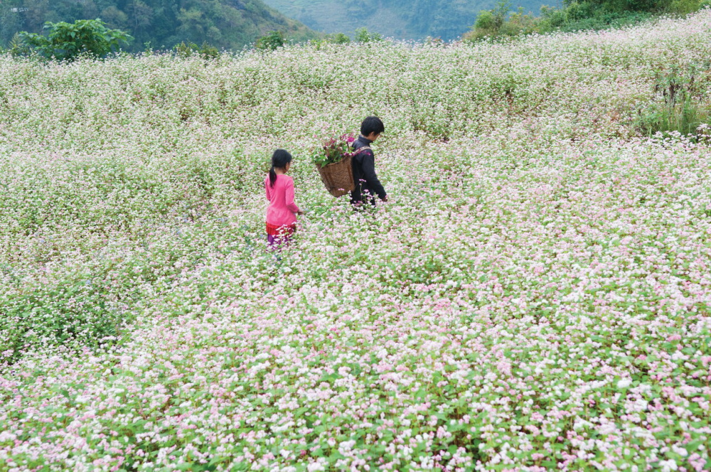
Each season in Ha Giang captivates travelers with its distinct beauty. Late autumn brings fields of triangular buckwheat flowers blooming in vibrant pink across the rocky plateau. Spring buzzes with the sounds of panpipes, traditional dances, and cultural festivals. In summer, winding mountain passes lead to peaceful villages nestled among the clouds.
Perhaps these elements are why Ha Giang never lacks visitors. Some come to be amazed by the grandeur of mountains and forests. Others return to experience the slow pace of everyday life. And some souls need only witness a blooming flower season to feel compelled to stay. Ha Giang always offers reasons for travelers to return.
1.1 Information about the Ha Giang and Tuyen Quang merger
From July 1, 2025, Ha Giang will officially merge with Tuyen Quang to form a new province named Tuyen Quang. The new province will cover nearly 13,800 square kilometers with a population of over 1.7 million people, comprising 7 wards and 117 communes. The administrative center will be located in Tuyen Quang. This represents an important step in the reorganization of administrative units, carefully prepared to ensure stability and smooth operation of the government system.
Beyond organizational aspects, the merger also opens a new chapter in comprehensive development vision. The union goes beyond geography and administrative structure, bringing together regions with many commonalities in culture, history, and resource potential. This creates the foundation for sectors such as economy, education, services, transportation, and tourism to gradually harmonize and develop sustainably in the future.
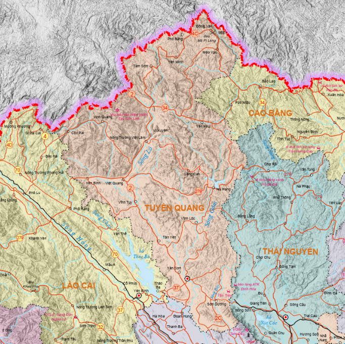
1.2 Tourism advantages of Ha Giang after the merger
The combination of Ha Giang’s landscapes and Tuyen Quang’s culture creates an opportunity to form a continuous tourism route from revolutionary war zones to the Thanh Thuy international border gate. This expansion not only extends geographical space but also creates advantages in linking tourism resources, services, and inter-regional transportation infrastructure.
Ha Giang impresses visitors with its diverse ecosystem, vibrant living cultural heritage, and magnificent mountain passes. In 2024, the province welcomed over 3.2 million visitors, with revenue exceeding 8 trillion VND. Tourism products ranging from nature exploration and cultural experiences to resorts and adventure sports are developed year-round, creating sustainable appeal that isn’t affected by seasonality.
Tuyen Quang, meanwhile, is a land of historical depth with over 650 relics, including 182 nationally ranked sites. Traditional festivals, especially the Mid-Autumn Festival and early spring religious activities, attract tens of thousands of visitors each year. When the Tuyen Quang – Ha Giang expressway is completed in late 2025, journeys to these heritage lands and karst plateaus will be more seamless and convenient than ever.
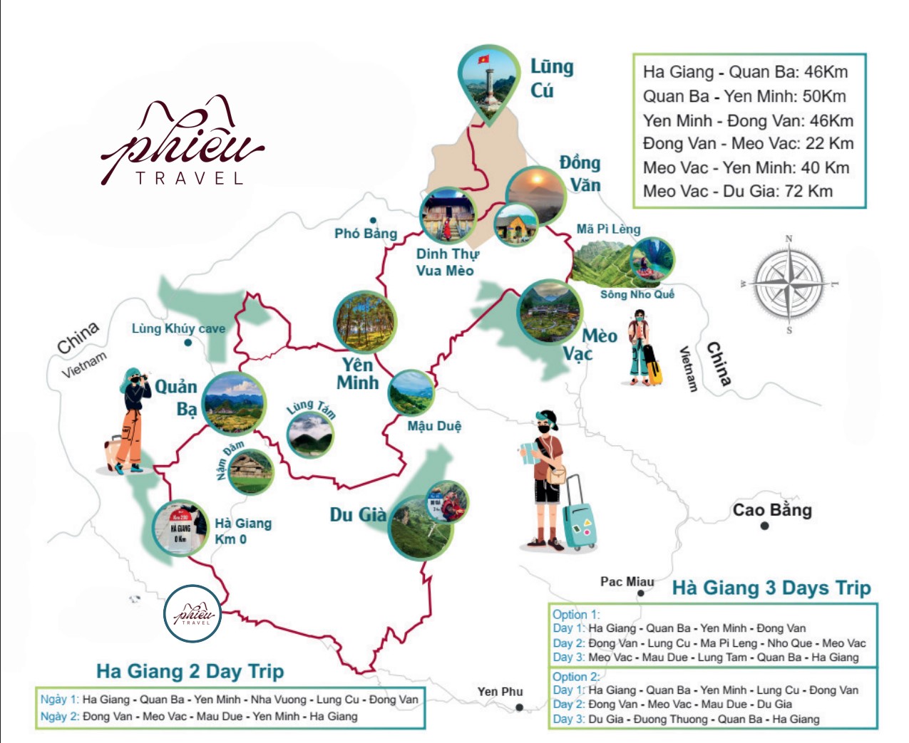
2. Ha Giang Tourism Map: Must-Visit Destinations
Along the Ha Giang tourism map are a series of captivating destinations, including:
2.1 Dong Van Karst Plateau
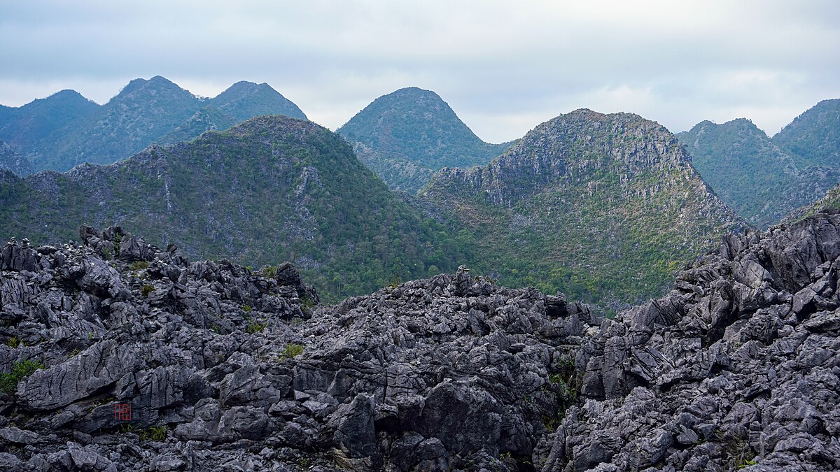
The Dong Van Karst Plateau sits at elevations between 1,000-1,600 meters, spanning four districts: Quan Ba, Yen Minh, Dong Van, and Meo Vac. With ancient geological structures millions of years old, this area has been recognized by UNESCO as a Global Geopark. The sharp, cat-ear-shaped limestone formations across the mountainsides not only create distinctive landscapes but also serve as valuable traces of Earth’s formation history.
From Ha Giang City, you’ll travel over 150 km with many challenging switchbacks to reach Dong Van. September through November is the golden rice harvest season, with terraced fields glowing in brilliant yellow. From November to December, buckwheat flowers blanket the hillsides, turning the plateau pink. The best time to visit is between 6-8 AM to experience the plateau’s beauty in its fullest!
2.2 Ma Pi Leng Pass
Ma Pi Leng Pass stretches approximately 20km, reaching heights of nearly 1,200 meters along National Highway 4C connecting Dong Van and Meo Vac. The winding road cuts through sharp, cat-ear limestone mountains, with sheer cliffs on one side and the quiet Nho Que River flowing below. Dubbed the “King of Northern Passes,” Ma Pi Leng attracts adventure enthusiasts eager to experience the raw beauty of Ha Giang’s rocky plateau firsthand.
Between 6-8 AM is the ideal time to enjoy views from the pass summit. Early morning sunlight breaks through clouds, illuminating the emerald Nho Que River as it winds between gray limestone formations, creating a scene straight from a painting. Surrounding the pass are villages of H’Mong, Tay, Lo Lo, and Nung people nestled against mountain walls. Life here remains peaceful, deeply connected to the challenging terrain of this frontier region.
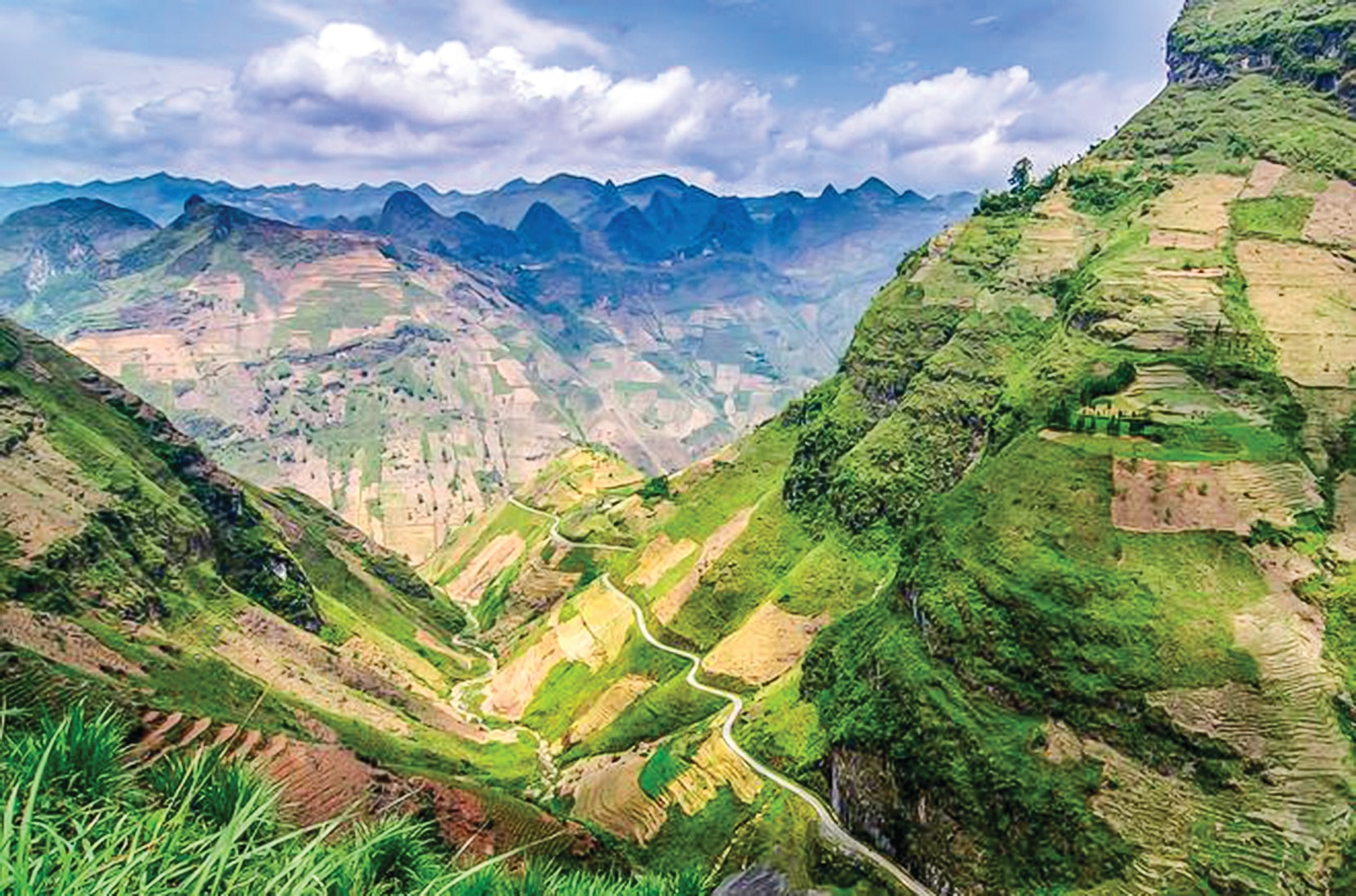
2.3 Hoang Su Phi Terraced Fields
Located in western Ha Giang, Hoang Su Phi is famous for over 3,700 hectares of layered terraced fields. During the water-filling season in May-June, the entire area transforms into a giant mirror reflecting clouds and sky. When rice ripens in September-October, golden terraces spread across hills and mountains. Many field sections in villages like Nam Ty, Ban Luoc, and Ban Phung have been classified as National Heritage Sites.
From downtown Ha Giang City, you can reach Hoang Su Phi via National Highway 2, then turn onto Provincial Road 177. Continue through Tan Quang commune, turn right at Ban Che Elementary School, and after about 1.5km, you’ll enter the terraced field area. The route isn’t long but features many curves, requiring careful driving when passing through steep mountain sections.
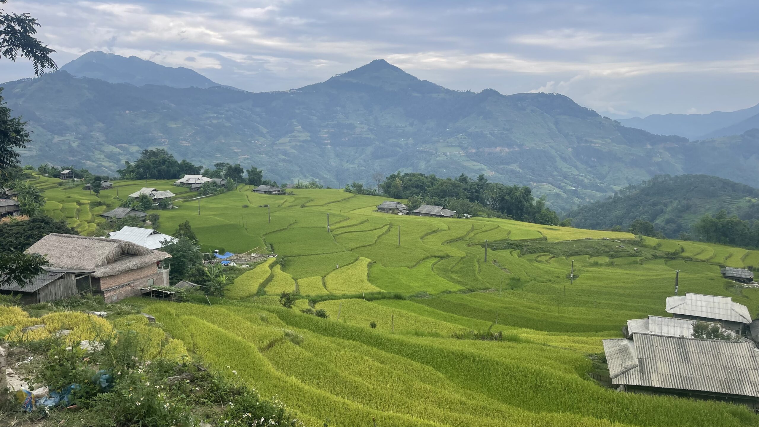
2.4 Du Gia
Du Gia lies peacefully in a green valley in Yen Minh district, about 70km from Ha Giang City. Less crowded than Dong Van or Meo Vac, this is a perfect stop for those seeking tranquility and pristine beauty. Tay stilt houses nestle beside rice fields, gentle streams flow year-round, and the simple scenery creates a space deeply characteristic of northern highland forests.
October to May is the ideal time to explore Du Gia. The dry season brings mild sunshine and fresh air, perfect for trekking through terraced fields or visiting Du Gia waterfall. To get here from Ha Giang, follow National Highway 4C toward Yen Minh, continue to Mau Due, then turn onto Provincial Road DT181. The journey covers about 70km, mostly winding mountain roads.
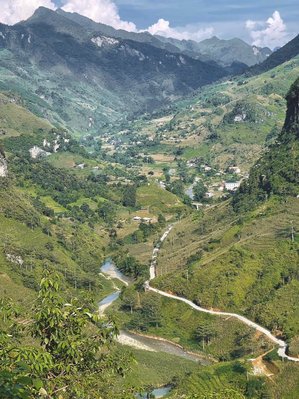
2.5 Lo Lo Chai Cultural Village
Lo Lo Chai Cultural Village sits at the foot of Lung Cu Flag Tower. This is where the Lo Lo people have lived and preserved their culture intact through generations. The village carries a contemplative, nostalgic beauty with earth-walled houses, cooking smoke drifting through the evening, and the slow rhythm of highland life.
In Lo Lo Chai, you can follow locals to learn weaving techniques, embroidering costumes, or listen to panpipes and drums during festival seasons. Each buckwheat flower season, the gentle pink-purple hues spread throughout the village. In spring, the village resembles a painting when peach blossoms, plum flowers, and yellow mustard bloom against the backdrop of gray cat-ear rocks.
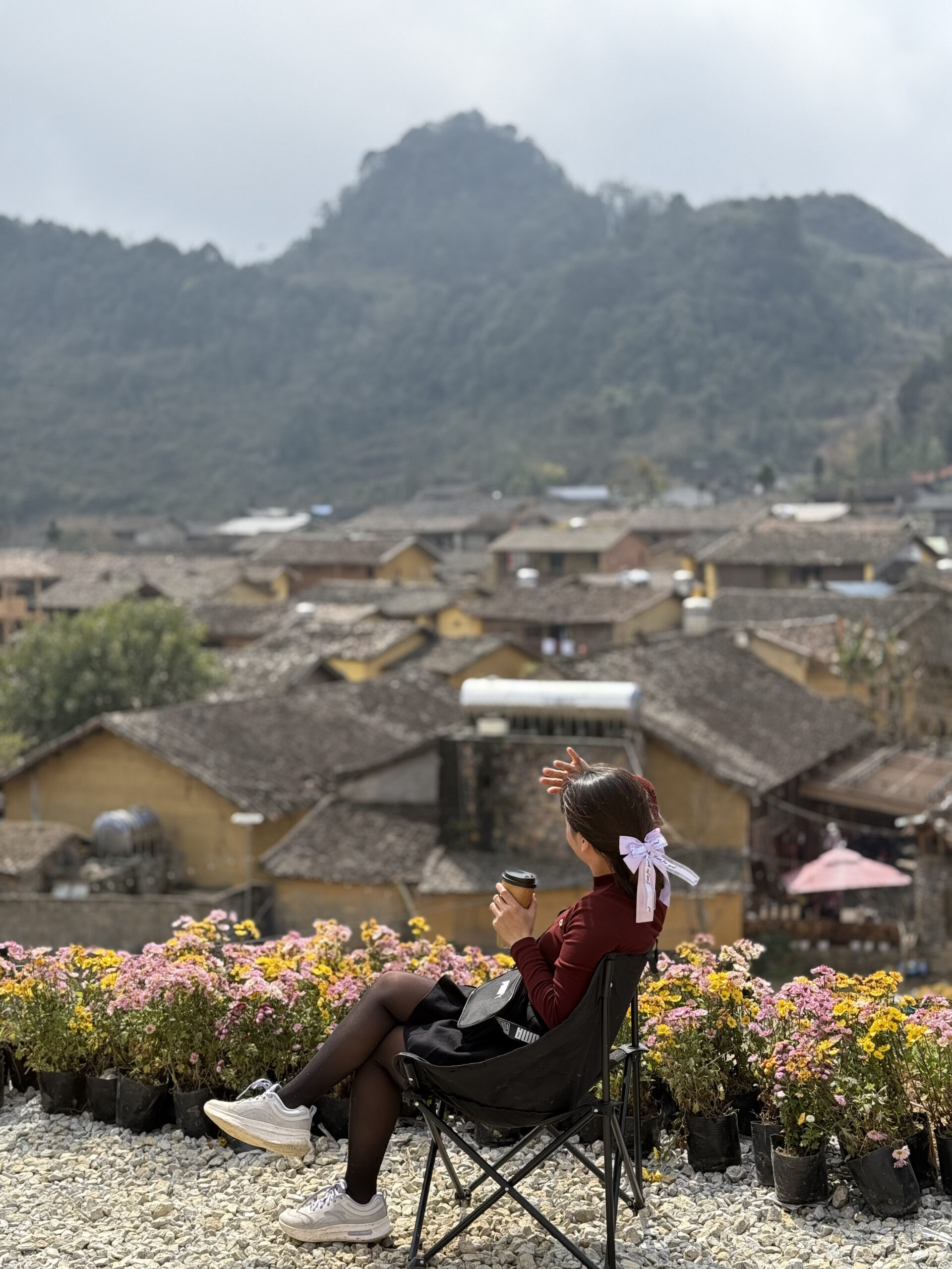
2.6 Sung La Valley
Sung La sits in the middle of the Dong Van Karst Plateau, nicknamed “the flower blooming on rock.” It stands out with moss-covered earth-walled houses, surrounded by pink buckwheat flowers and bright yellow mustard in spring. The scenery looks like it stepped out of a film, especially when you visit “Pao’s House” – the setting of the famous movie of the same name, now an unmissable stop when visiting Ha Giang.
Sung La also attracts visitors with its quietly preserved cultural values in each house, children’s laughter, and the slow-paced life of the Hmong, Lo Lo, and Dao people. Walking along small dirt paths, you’ll encounter locals carrying grass on their backs, weaving fabrics, or drying corn in front of their homes. Every corner here carries a peaceful atmosphere that makes visitors feel attached and reluctant to leave.
2.7 Noong Lake
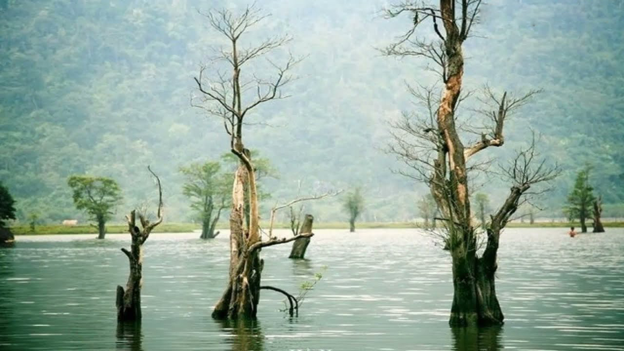
About 23km from downtown Ha Giang, Noong Lake is a natural freshwater lake nestled in the quiet forest mountains of Phu Linh commune. Each flood season, dozens of ancient tree stumps emerge from the lake, creating a mysterious, unusual landscape. In early mornings, when mist still hangs in the air, you can take a boat across the clear water, quietly watching mountains and hills reflect on the still surface.
At Noong Lake, visitors also have the chance to meet Tay and H’Mong people living around the lakeshores. Stilt houses nestled on hillsides, the sound of rice pounding, children’s laughter, and the aroma of grilled fish by the fire are things that make travelers reluctant to leave. An evening camping by the lake, enjoying smoked pork, and listening to forest stories will be an unforgettable experience.
2.8 Quan Ba Twin Mountains
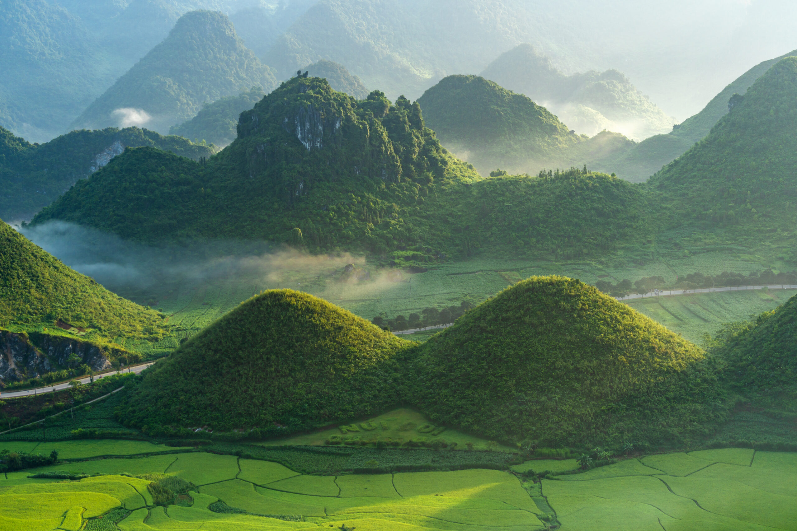
Located at the gateway to the Dong Van Karst Plateau, the Quan Ba Twin Mountains appear like soft mounds in the middle of Tam Son valley. The two rounded, symmetrical peaks are covered in green grass year-round. Each early morning, light mist hangs over the mountain tops, making the scene look ethereal, like an ink painting in this frontier region.
From downtown Ha Giang City, you can reach Quan Ba Twin Mountains after about 1 hour and 30 minutes of driving along National Highway 4C. The common route goes through Nguyen Trai Street, connecting to National Highway 2, then turning onto National Highway 4C. After passing Bac Sum slope for a few kilometers, you’ll see two mountains standing close together – that’s your destination.
3. Ha Giang Tourism Map: Dining Spots
One thing that captivates visitors to Ha Giang is the local cuisine. Whether for breakfast, lunch, or dinner, the karst plateau can satisfy you with numerous famous dining spots. Here’s a Ha Giang tourism map of places to eat:
3.1 Breakfast spots
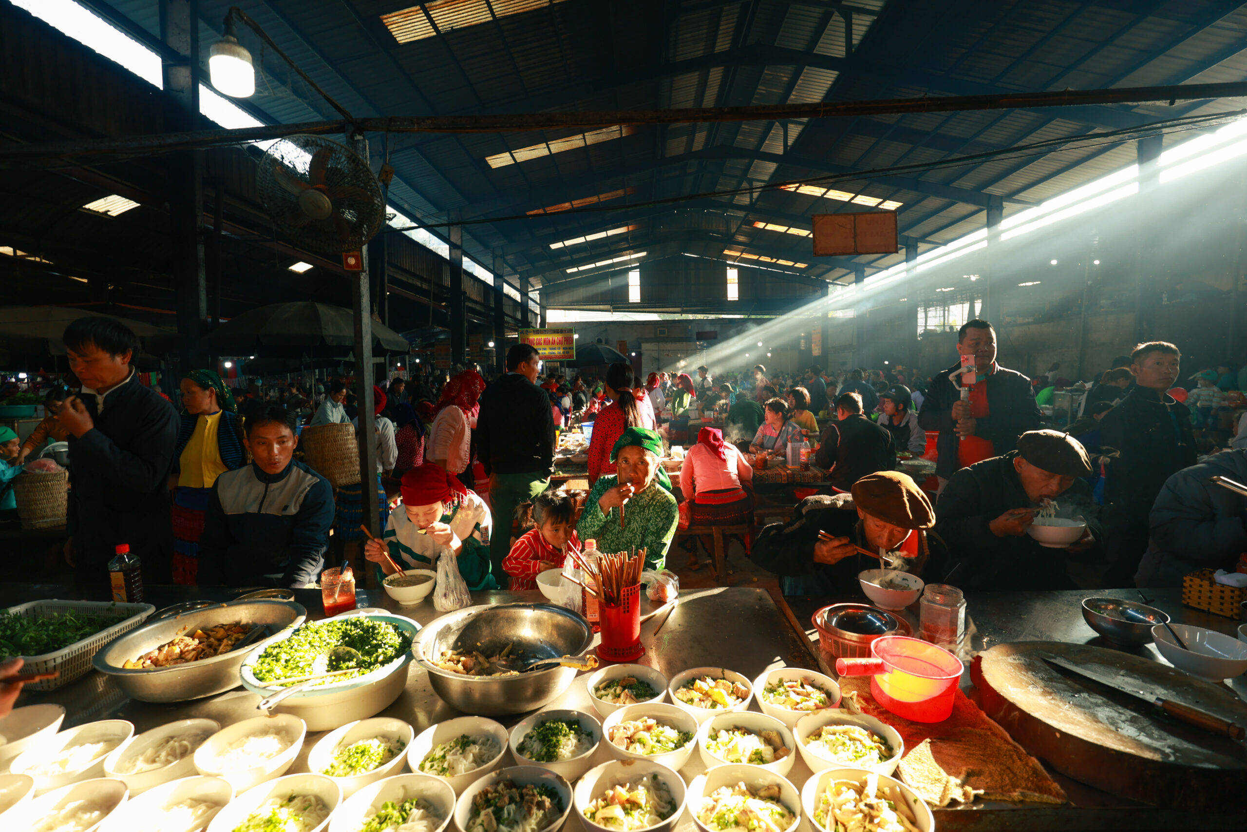
At highland markets like Dong Van, Meo Vac, and Ma Le, locals usually gather from very early morning. In the cold morning mist, you’ll find small stalls selling thang co (traditional H’mong soup), men men (corn porridge), sour pho, and more to serve early market-goers. Sitting by a fire, enjoying simple local dishes while watching people pass by is a wonderful way to experience the authentic rhythm of life here.
3.2 Dinner venues
In the evening, you can enjoy specialty dishes and hot pots at restaurants in Ha Giang City, Dong Van town, and other locations. Some notable places:
Com Dan Toc Restaurant
Traditional Muong and Tay stilt house architecture. Specializes in dishes like wild boar, forest vegetables, stream fish, and buffalo meat.
- Address: 18 Nguyen Van Linh, Tran Phu Ward, Ha Giang City.
Au Viet Restaurant
Specializes in hot pots including beef, goat, chicken, fish, and duck with distinctive highland flavors. Spacious, elegant setting.
- Address: 105 National Highway 4C, Dong Van, Ha Giang.
Ba Tu Lan Restaurant
Small, nostalgic space with wood as the main material. Rich flavors at reasonable prices. Offers specialties like Chinese sausage, chicken hot pot, five-color sticky rice, and steamed rice rolls.
- Address: 125 Group 3, Dong Van Town, Ha Giang.
3.3 Lunch spots
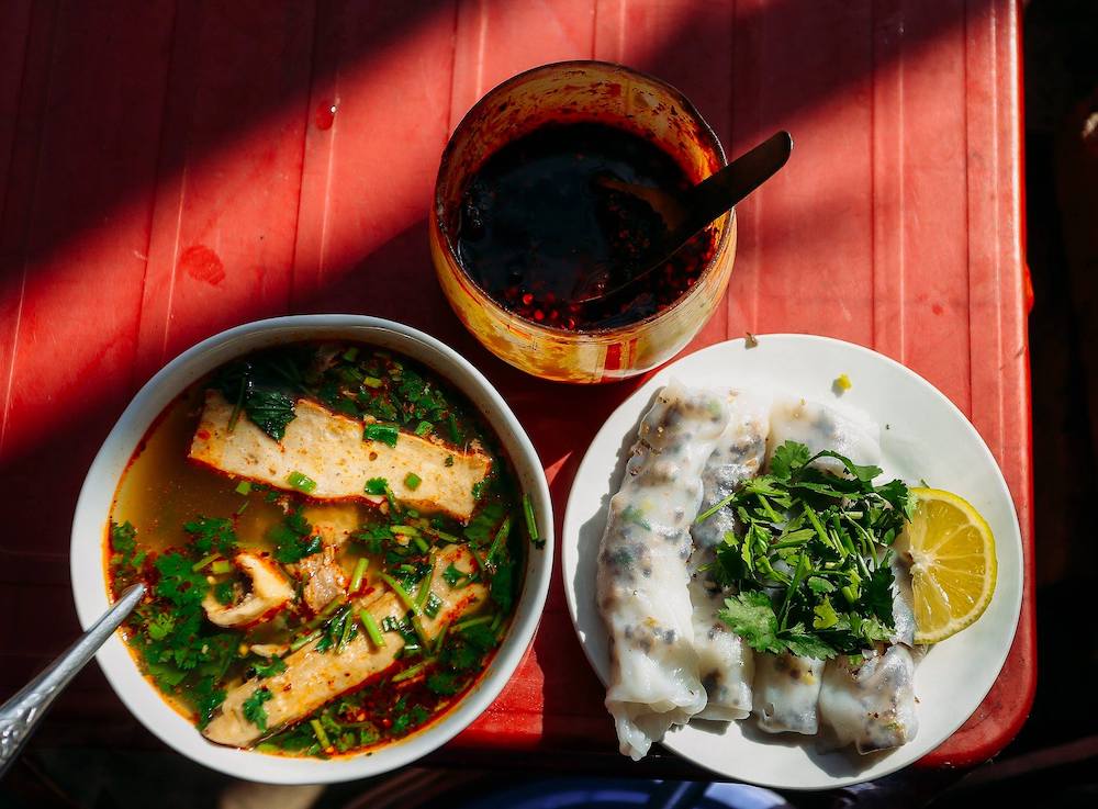
For lunch, try authentic Ha Giang specialties like au tau porridge, steamed rice rolls, or sour pho. Some famous lunch spots in Ha Giang include:
Ba Ha Rice Rolls
Thin rice rolls served with sweet broth made from bones and herbs. Fillings include lean pork and wood ear mushrooms. Rich flavor at reasonable prices.
- Address: 31 Old Street, Dong Van.
Au Tau Porridge Shop
Porridge with distinctive aroma and sweet, nutty rice flavor. Contains au tau seeds, pork knuckles, and minced pork. Very warming and also has medicinal properties.
- Address: Group 5, Tran Hung Dao, Nguyen Trai Ward, Ha Giang City.
Ly Dinh Sour Pho
Pho with a unique flavor compared to lowland varieties, mixed with sweet and sour sauce. Toppings include roast meat, char siu, Chinese sausage, and herbs.
- Address: 90C Nguyen Trai Street, Group 18, Ha Giang, Vietnam
3.4 Coffee shops
During your mountain exploration journey, a hot cup of coffee by a window overlooking Ha Giang’s misty mountains is a must-try experience. Here are Phieu Travel’s recommendations:
Nui Cam Cafe
Perched on a high hill with direct views of layered mountains, this is an ideal spot to watch the entire Ha Giang City in the early mist. Quiet atmosphere, perfect for those seeking a private corner to let their mind wander with the clouds.
- Address: Le Thanh Tong Street, Nguyen Trai Ward, Ha Giang City.
Manh Km0 Cafe
Located right at the famous Km0 milestone, this cafe is a familiar stop for travelers. You can enjoy rich highland coffee while capturing check-in moments at one of Ha Giang’s iconic symbols.
- Address: KM 0 milestone, Nguyen Trai Ward, Ha Giang City.
H’Mong Pub & Cafe
Cozy riverside space, featuring local beverages like honey coffee, Shan snow tea, or wild fruit juices.
- Address: 237 Riverside Street, Group 07, Ha Giang City.
3.5 Places to buy specialties
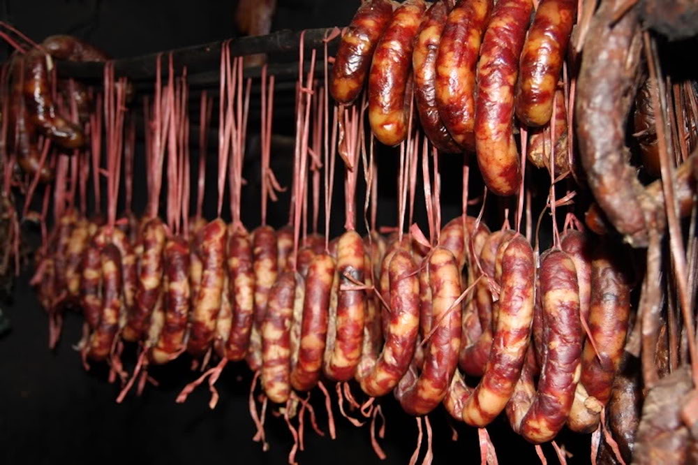
If you want to bring home flavors from the highlands, consider purchasing smoked buffalo meat, lap suon (local sausage), ancient Shan snow tea, and more. These specialties are sold at highland markets or local businesses. Some places you should visit:
- Dong Van market.
- Meo Vac market.
- Yen Minh market.
- Quan Ba market.
3.6 Romantic spots for couples
For couples seeking romantic dining spaces in Ha Giang, consider these venues:
Phien – Coffee, Beer & Wine
Rustic, intimate space with wooden elements, soft yellow lighting, and gentle jazz music. The cafe is particularly suitable for couples to chat and sip coffee or wine during a relaxing evening in the mountain town.
- Address: 11 Old Street, Dong Van.
Mr. Hung Bar Restaurant
Located in the heart of the mountain town, Mr. Hung Bar Restaurant is ideal for enjoying Italian dishes in a nostalgic atmosphere. The menu includes vegetarian options, suitable for various tastes. The spacious rooftop overlooks distant mountain ranges, offering a private space for couples wanting to enjoy dinner in a romantic and quiet setting.
- Address: Doi Street, Lam Dong Village, Phuong Thien Commune, Ha Giang.
Ha Giang Vegetarian, Vegan Restaurant
Cozy atmosphere, primarily using wooden materials to create a friendly, gentle feeling. Diverse vegetarian menu with well-prepared dishes at reasonable prices. Perfect for couples seeking a quiet place to dine and talk.
- Address: 101b Nguyen Thai Hoc, Minh Khai, Ha Giang.
Men Men of Ha Giang: Discover the Hmong’s traditional soul food
4. Ha Giang travel route map: Captivating Check-in Spots
When visiting Ha Giang’s karst plateau, don’t miss these stunning check-in locations:
4.1 Nho Que River
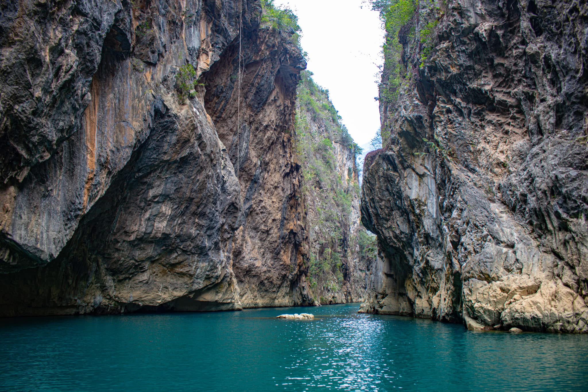
Hidden beneath Ma Pi Leng Pass, the Nho Que River appears like an emerald silk ribbon stretched across rocky mountains. The river flows quietly through steep rock walls, creating a spectacular painting amid the Dong Van Karst Plateau. The ideal time to view the river is from September to April, when the weather is dry and clear, and morning mist still lingers on mountain slopes.
One of the most memorable experiences is taking a boat along the river, crossing through Tu San Canyon – known as the deepest canyon in Southeast Asia. Between two gigantic rock walls rising straight beside the boat, space seems to stand still. The gentle splash of water, wind brushing through your hair, and rock shadows reflecting on the calm river will overwhelm you with the majestic beauty of nature in this frontier region.
4.2 Lung Cu Flag Tower
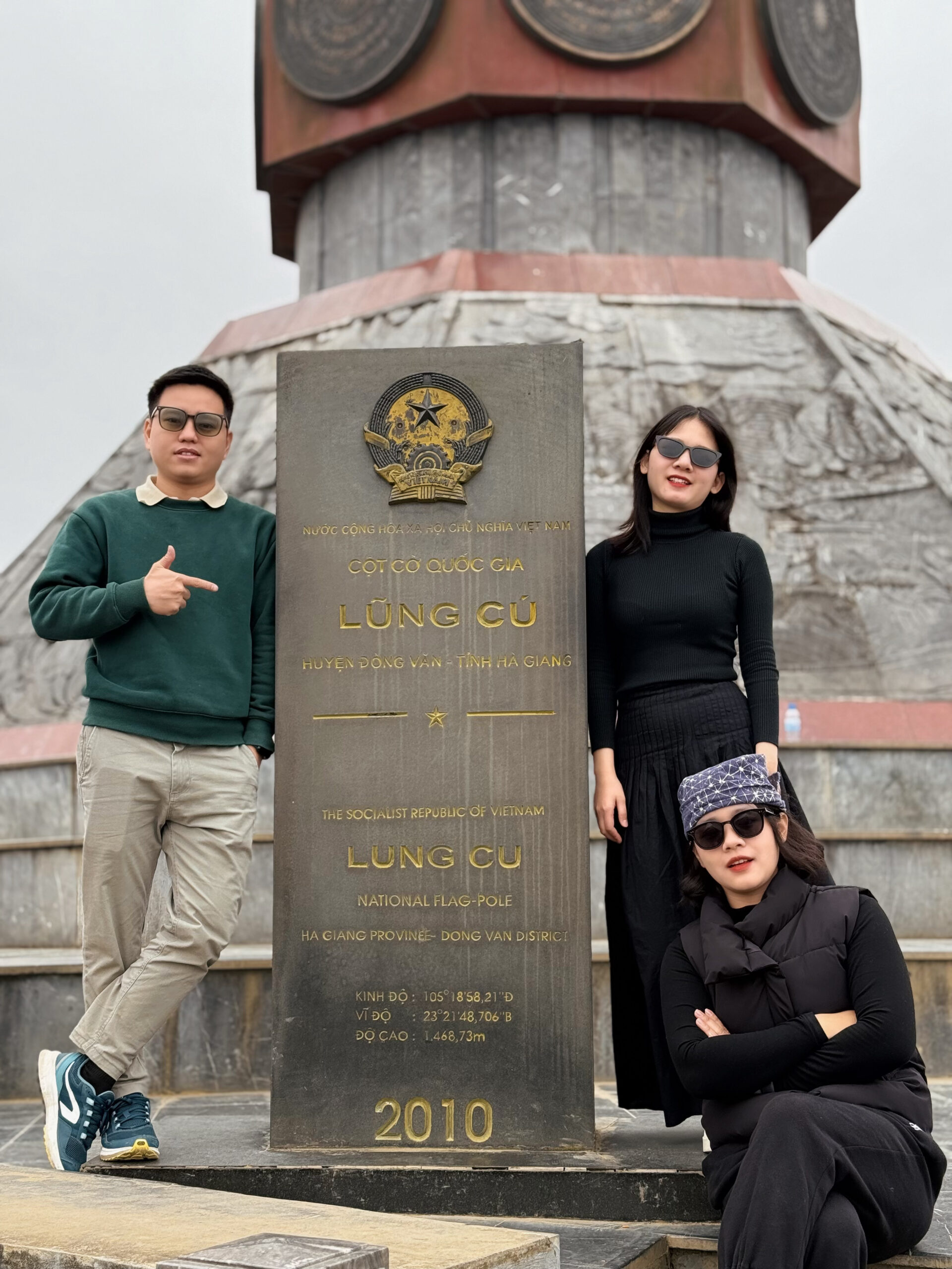
Lung Cu Flag Tower stands on Dragon Mountain, marking the sacred northernmost point of Vietnam. The red flag with yellow star, 54 square meters in size, flies proudly against the border sky, filling visitors with patriotic pride. To reach the top, you’ll follow the mountainside and climb 839 stone steps.
The tower’s architecture impresses with its solid octagonal design. The base features eight exquisite green stone reliefs depicting Vietnamese history, along with eight bronze drums representing long-standing cultural values. From here, you can capture the entire Ha Giang border region in your view, feeling the quiet yet majestic presence of Vietnam’s northernmost territory.
4.3 Dong Van Old Quarter
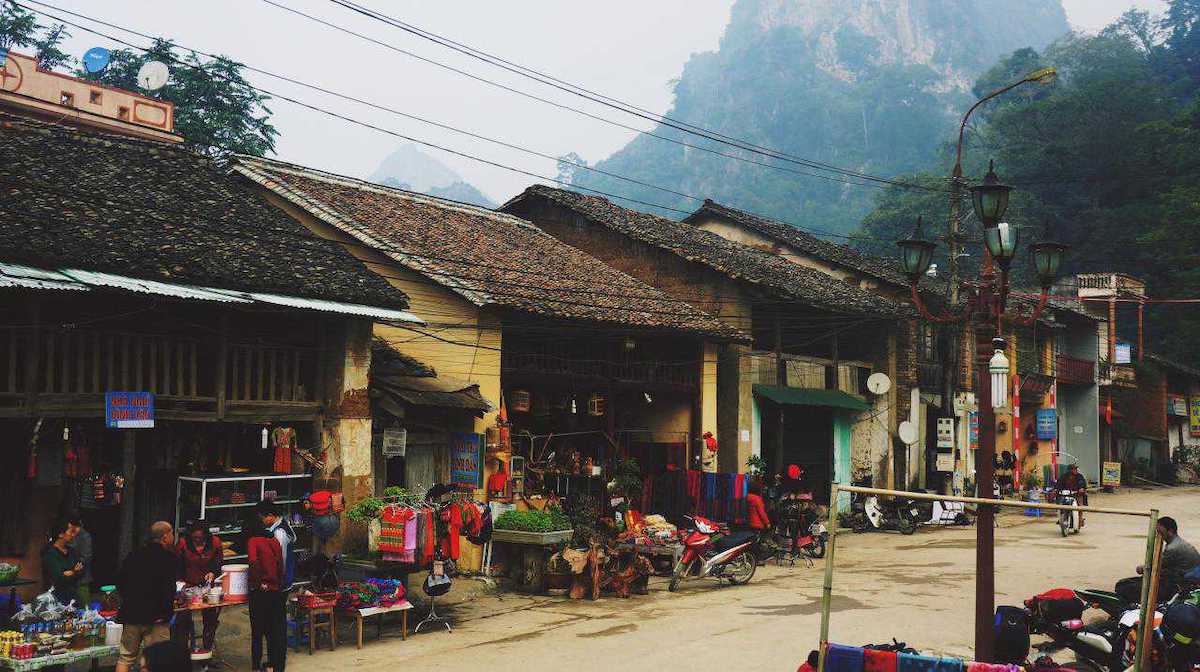
Dong Van Old Quarter was established in the early 20th century, situated amid the somber gray rocks of Ha Giang plateau. About 40 ancient houses are still preserved, featuring thick earth walls, yin-yang tiled roofs, and stone floors characteristic of northern mountain communities. Life here maintains its slow rhythm, separated from modern hustle and bustle.
On full moon nights, the old town glows with lantern light. The night market offers traditional foods like corn cakes, thang co, and corn wine, alongside stalls selling brocade and ethnic musical instruments. This is when H’mong, Dao, Lo Lo people from nearby villages gather to trade and socialize.
4.4 Pao’s House
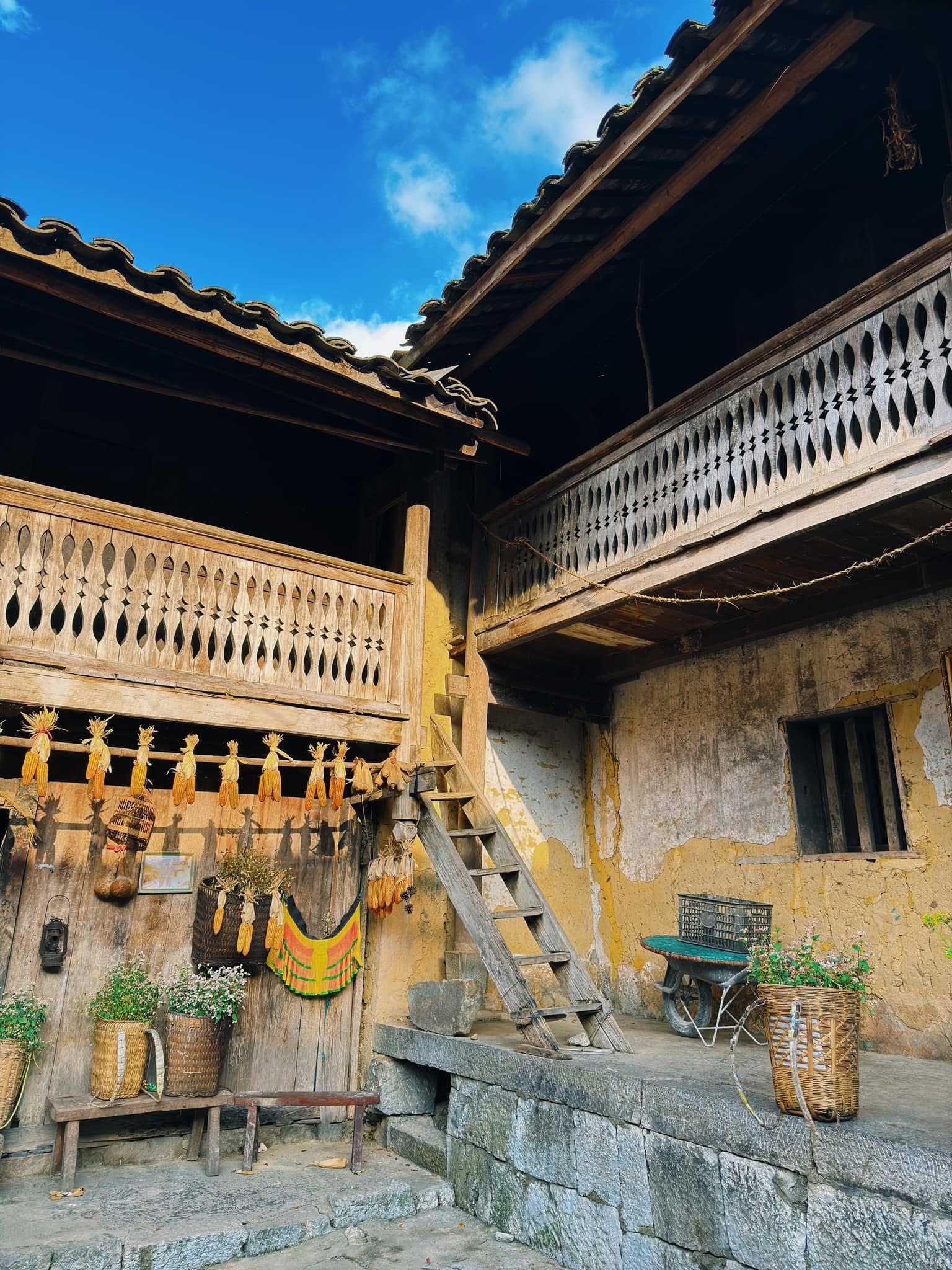
Pao’s House is located in Sung La Valley, within Lung Cam Cultural Village (Dong Van district). This over 70-year-old house was the main setting for “The Story of Pao” – a film that won the Golden Kite Award and was featured at the 2007 Cannes Film Festival. Since the film’s success, this small house amid rocky mountains has become an essential stop on the Ha Giang exploration route.
The house features traditional H’Mong architecture with earth walls, yin-yang tiled roofs, a wooden gate without hinges, and hand-stacked stone fences. In front is a wide packed-earth yard, while the back leans against a rocky mountain. September to January, when Sung La is filled with buckwheat flowers, yellow mustard, and wild sunflowers – is the ideal time to visit Pao’s House.
5. Ha Giang 4-Day 3-Night Exploration Itinerary
You might not know this, but in just 4 days and 3 nights, you can experience the entire Ha Giang tourism map. Here’s Phieu Travel’s suggested itinerary:
Day 1: Ha Giang – Bac Sum Pass – Quan Ba Heaven Gate – Quan Ba Twin Mountains – Yen Minh – Vuong Family Mansion – Dong Van
From the city, start exploring Bac Sum Pass, stop at Quan Ba Heaven Gate, and view the twin mountains amid the cloudy valley. Along the way, Can Ty slope and villages of Hmong and Dao people appear among fields and rocky mountains.
Stop for lunch in Yen Minh. In the afternoon, continue through Tham Ma, Pho Cao, and visit the Vuong Family Mansion. End the day in Dong Van town to prepare for the next day’s journey.
Day 2: Dong Van – Ma Pi Leng Pass – Nho Que River – M-shaped Curve – Duong Thuong – Du Gia
After breakfast, leave Dong Van, cross Ma Pi Leng Pass, and take a boat tour on the Nho Que River around 9:45 AM. Continue along the route through the M-shaped curve, stop for lunch in Mau Due, then cross through Duong Thuong. If time allows, visit Lung Ho before spending the night in Du Gia.
Day 3: Du Gia – Duong Thuong – Nam Dam Cultural Village
In the morning, after breakfast at the homestay, visit Du Gia waterfall and a nearby village for walking or relaxing before hitting the road. Continue through Duong Thuong, have lunch in Thai An, and travel toward Nam Dam village.
Around 5 PM, check into a homestay and walk around the village to learn about Dao people’s living space. In the evening, enjoy a local dinner and participate in cultural exchanges with villagers.
Day 4: Nam Dam – Thai An – Ha Giang City – Hanoi
Day 4 begins with exploring Lung Khuy Cave. Have lunch in Quan Ba town, then visit Lung Tam brocade weaving village to learn about traditional dyeing, spinning, and linen weaving processes. In the afternoon, continue through Thai An, stop at A Boong waterfall and Cat Ly camping spot before the tour ends.
4 Days 3 Nights Ha Giang Loop tour: Slow down, see more, feel more
6. Phieu Travel Helps You Conquer Destinations Along the Ha Giang Loop
If you’re not experienced in arranging your own itinerary, let Phieu Travel make your journey smoother and more complete. We organize Ha Giang exploration tours with flexible options such as self-driving, riding behind a guide, or traveling by private car. Our journeys are designed in a logical sequence, helping you fully experience each destination without rushing or overexertion.
Why choose to travel with Phieu Travel:
- Diverse itineraries: 2D1N, 3D2N, 4D3N tours featuring selected highlights, just enough to clearly experience the beauty of each region.
- Door-to-door transportation: Round-trip transportation services from Hanoi, Vinh, Cat Ba, Sapa, Thai Binh, Ha Long, and Hai Phong help save time and cost.
- Local guides: Knowledgeable about culture and terrain, accompanying you closely on every route.
- Clear policies: Transparent terms, maximum support, and ensuring customer benefits throughout the journey.
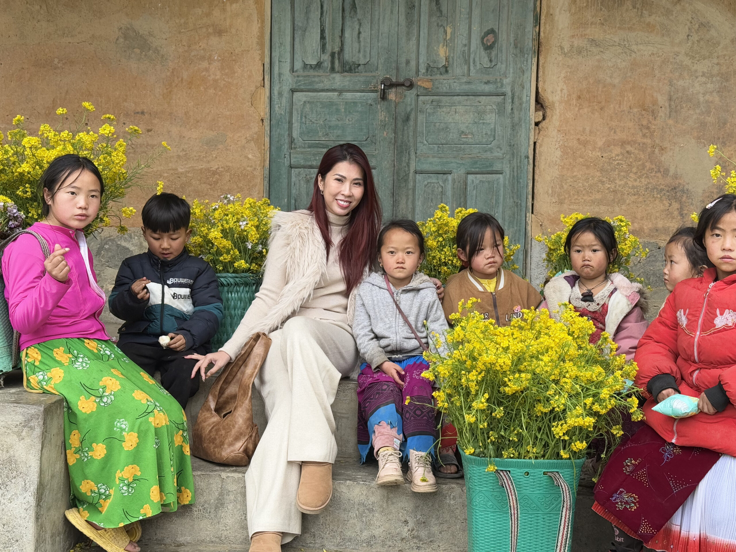
If you’re planning to fully explore the Ha Giang travel route map, Phieu Travel is ready to accompany you. We design journeys with flexible itineraries, suitable transportation, and a team of local guides who understand every route. All experiences are meticulously prepared so you can confidently enjoy the beauty of the karst plateau.
Read more:
- The Best Time to Visit Ha Giang: A Seasonal Guide to Flowers & Festivals
- Cloud hunting in Ha Giang: 7 Breathtaking spots that will capture your heart
- The White Cliffs of Ha Giang: A Path for Adventurous Hearts
- Is There a Ha Giang Airport and How to Reach Ha Giang by Air Travel

You Might Also Like
Ha Giang Weather in September: Complete Guide for Travelers
Exploring the magnificent Ha Giang Loop in September offers travelers a perfect balance of favorable[...]
Quan Ba Twin Mountains: Ha Giang’s Iconic Fairy Hills and Complete Travel Guide
The mystical Quan Ba Twin Mountains rise from the emerald valleys of Ha Giang like[...]
Vuong family mansion: the architectural marvel and cultural legacy of Ha Giang
Deep in Vietnam’s northern highlands, where mist-shrouded mountains meet terraced rice fields, stands a testament[...]
Ha Giang Loop Safety Tips: How to Ride Securely in Vietnam’s Northern Mountains
The Ha Giang Loop, with its winding mountain roads and breathtaking landscapes, offers one of[...]
The Ultimate Guide to the M-Shaped Curve on Ha Giang Loop
Vietnam’s remote northern province of Ha Giang hides a natural wonder that has captivated adventurous[...]
Most Beautiful Places to Visit in Vietnam: Essential Destinations and Insider Tips
Vietnam captivates travelers with its stunning landscapes, rich cultural heritage, and warm hospitality. From mist-shrouded[...]
Beyond the Beaten Path: Discovering Ha Giang Province in Northeast Vietnam
Ha Giang Province in Northeast Vietnam stands as one of the country’s last frontiers for[...]
3 Comments
Rainy season in Ha Giang: what to expect, when to go, and travel tips
Vietnam’s northern frontier reveals a different face during the rainy season, transforming Ha Giang’s limestone[...]