
The Ha Giang Loop, Vietnam’s most magnificent motorcycle route, showcases breathtaking limestone peaks and vibrant ethnic cultures across its winding roads. However, timing this adventure can make the difference between an unforgettable journey and a dangerous ordeal. At Phieu Travel, we’ve guided countless travelers through these mountain passes, witnessing both perfect conditions and perilous situations when nature unleashes its fury. Understanding the worst time to do Ha Giang Loop isn’t just practical advice it’s essential knowledge that could save your trip or even your life.

1. When is the worst time to ride the Ha Giang Loop?
While the Ha Giang Loop offers spectacular scenery year-round, certain seasons present genuine hazards that can transform dream journeys into nightmares. Weather patterns in northern Vietnam follow distinct seasonal cycles, with two particularly challenging periods that even experienced riders approach with caution.
1.1 Rainy Season (June – August): real hazards and firsthand accounts
The summer monsoon transforms Ha Giang’s dramatic landscape into a zone of unpredictable danger. Between June and August, rainfall averages increase dramatically, often exceeding 300mm per month. What makes this season particularly treacherous isn’t just the volume of rain but its intensity and unpredictability.
Sudden downpours can reduce visibility to near zero within minutes. The limestone-rich soil quickly saturates, turning firm pathways into slippery hazards and triggering frequent landslides. Our guides have witnessed entire sections of road disappear without warning as the mountainside gives way.
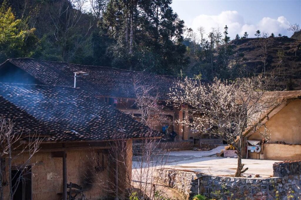
One particularly harrowing account comes from our guide Minh, who led a group in July 2022. We were approaching Ma Pi Leng Pass when the sky darkened suddenly, he recalls. Within minutes, the rain became so heavy we couldn’t see five meters ahead, and the road surface transformed into a flowing stream. The group sought shelter in a small roadside structure, watching as rocks and mud slid across the path they had just traveled. They remained stranded for nearly 18 hours before conditions improved enough to cautiously continue.
Rivers swell dramatically during these months, sometimes rising several meters overnight. The emerald-green Nho Que River, usually a highlight of the journey, can become a roaring torrent that threatens bridges and riverside roads. Boating activities, popular among visitors, are frequently suspended due to dangerous conditions.
Local emergency services often become overwhelmed during severe weather events. In remote areas, help may be hours away or entirely unavailable until conditions improve. This isolation compounds the danger for travelers caught in serious situations.

Visiting Ha Giang in June: Weather, Itinerary & Must-See Sights
1.2 Winter (December – January): fog, cold, and road safety
The winter months present a different but equally challenging set of hazards for Ha Giang Loop travelers. From December through January, temperatures in the highlands can plummet below 5°C (41°F), with occasional drops near freezing at higher elevations like Dong Van and Meo Vac.
Dense fog becomes a daily occurrence, particularly in the morning hours when visibility can be reduced to less than 10 meters. These conditions make navigating the loop’s hairpin turns and cliff-edge roads exceptionally dangerous. The fog often persists until midday, significantly shortening the safe riding window.
The cold itself becomes a safety concern for riders. Without proper thermal gear, the wind chill created by motorcycle riding can lead to hypothermia, particularly when combined with unexpected rain or mist. Fingers become numb, reducing brake and throttle control precisely when you need it most.
Winter riding requires constant vigilance, explains Tuan, another Phieu Travel guide. You might start in clear conditions, then suddenly enter a pocket of fog where you can barely see the road edge. The temperature difference between sunny and shaded areas can be 10 degrees or more.
Road surfaces deteriorate during winter as morning dew and fog create persistent dampness. In shaded mountain passes, patches of road may remain slick throughout the day. At higher elevations, occasional frost creates nearly invisible slippery sections that have caused numerous accidents.
The reduced daylight hours of winter (as little as 11 hours) compress travel times, often forcing riders to either start in darkness or finish after sunset. Neither option is safe on the challenging mountain roads where street lighting is virtually non-existent.

The Best Time to Visit Ha Giang: A Seasonal Guide to Flowers & Festivals
2. What happens during bad weather? (floods, landslides, & road closures)
When severe weather strikes the Ha Giang region, its effects cascade quickly through the fragile mountain infrastructure. Understanding these patterns can help you prepare for potential disruptions and make informed decisions about your journey.
Flash floods are among the most immediate dangers. The region’s steep terrain channels rainfall into valley floors with remarkable speed. Roads running alongside rivers or through low-lying areas can become impassable within hours of heavy rain. In July 2023, several sections of the loop were underwater for days, stranding travelers in remote villages.
Landslides occur with alarming frequency during heavy rain periods. The combination of steep slopes, thin soil coverage, and saturated ground creates perfect conditions for earth movement. Warning signs include fresh cracks in hillsides, sudden appearance of springs or seeps, and unusual sounds from the slopes above. If you notice these indicators, move quickly to safer ground.
Road closures happen regularly during extreme weather but information spreads slowly. Local authorities may block passage at checkpoints, but in remote areas, you might only discover an impassable section after traveling for hours. This uncertainty makes weather-contingent planning essential.
Power outages frequently accompany storms in the region. Even well-established towns like Dong Van and Meo Vac can lose electricity for extended periods. Bring portable power banks and consider how outages might affect your accommodation and meal plans.

2.1 Safety tips and emergency protocols
When faced with deteriorating weather conditions, your response in the first minutes often determines your safety. Our guides follow established protocols that have kept travelers safe through numerous weather events.
If caught in sudden heavy rain, seek immediate shelter rather than trying to push through. Small roadside structures, cafes, or homes of local residents offer better protection than continuing on increasingly hazardous roads. Most locals willingly shelter travelers during dangerous conditions.
Always carry an offline map application with pre-downloaded maps of the entire region. Cell service disappears quickly in remote areas, especially during storms. Applications like Maps.me or Google Maps (with offline areas saved) provide critical navigation support when visibility diminishes.
Pack emergency essentials in waterproof containers: a basic first aid kit, high-energy snacks, a flashlight with spare batteries, and a space blanket. These items weigh little but can be lifesaving if you become stranded.
Establish communication protocols with your traveling companions before departing. Agree on regular check-in times and what actions to take if someone doesn’t arrive at a designated meeting point. If traveling solo, share your daily route plan with your accommodation host.
If you encounter a flooded road section, never attempt to cross without clear visibility of the road surface. Flowing water as shallow as 15cm can sweep a motorcycle away. Wait for conditions to improve or seek local guidance about alternative routes.
2.2 How guides manage risks
Professional guides develop specialized knowledge for navigating the Ha Giang Loop’s seasonal challenges. Their experience offers valuable lessons for independent travelers facing uncertain conditions.
Phieu Travel guides maintain constant communication with a network of local contacts throughout the region. Before each day’s journey, they gather current information about road conditions, recent landslides, and weather forecasts for specific mountain passes. This real-time intelligence allows for route adjustments before encountering dangerous situations.
Weather pattern recognition becomes second nature for experienced guides. They observe cloud formations, wind shifts, and subtle environmental changes that often precede major weather events. When these warning signs appear, they don’t hesitate to alter routes or delay travel.
Relationships with local communities provide crucial support during emergencies. Our guides know which villages offer reliable shelter, which local homes might provide accommodation when hotels are full, and which community leaders can assist with emergency transportation if roads become impassable.
Equipment maintenance receives heightened attention during challenging seasons. Guides insist on regular brake checks, tire inspections, and mechanical reviews before departing each morning. They carry basic repair tools and know which problems can be addressed on the road versus which require professional assistance.
Alternative routes are always mapped in advance. While the classic loop follows a standard path, experienced guides maintain knowledge of secondary roads that might bypass dangerous sections during emergencies. Though these alternates might lack the scenic drama of the main route, they prioritize traveler safety above all.

3. How to adapt your itinerary in unpredictable weather
Flexibility becomes your greatest asset when navigating the Ha Giang Loop during challenging seasons. A well-planned journey includes built-in contingencies for weather disruptions, allowing you to experience the region’s beauty while minimizing exposure to its dangers.
Rather than planning a rigid day-by-day itinerary, adopt a modular approach that identifies key destinations but remains adjustable in sequence and timing. This approach lets you take advantage of good weather windows while having alternatives ready when conditions deteriorate.
Consider building extra buffer days into your schedule if traveling during risky seasons. These flexible days can absorb weather delays without forcing you to miss major highlights or rush dangerously through bad conditions to catch transportation connections.
Morning departures are crucial during both rainy season and winter. Starting early provides maximum daylight for navigation and increases the likelihood of completing each day’s journey before afternoon storms (common in summer) or early darkness (in winter). Aim to reach each day’s destination by 3:00 PM when possible.
Local weather forecasts provide general guidance but often lack precision for specific mountain areas. Supplement official forecasts with local knowledge by asking accommodation hosts, cafe owners, and other travelers about recent conditions. Their observations often prove more accurate than regional predictions.
3.1 Flexible routes and backup plans
The traditional Ha Giang Loop follows a counterclockwise circuit from Ha Giang City through Quan Ba, Yen Minh, Dong Van, Meo Vac, and back. However, maintaining flexibility in this route becomes essential during challenging weather periods.
Identify multiple potential overnight stops for each segment of your journey. If weather deteriorates, you might need to halt earlier than planned or push further to reach a larger town with better accommodation options. Having these alternatives pre-researched saves crucial decision-making time during deteriorating conditions.
Certain sections of the loop become particularly hazardous in bad weather. The stretch between Dong Van and Meo Vac, including the famous Ma Pi Leng Pass, features narrow roads with sheer drops that become treacherous in rain or fog. During high-risk seasons, consider arranging alternate transportation for this segment or be prepared to delay until conditions improve.
Develop a safety first decision framework for each day’s journey. Before departing, establish clear weather conditions that would trigger a route change, delay, or day spent in place. Having these thresholds defined in advance removes the pressure of in-the-moment decisions when conditions deteriorate gradually.
If significant weather systems threaten your trip, consider inverting your itinerary direction. Moving clockwise instead of counterclockwise might help you avoid the worst weather if storms are moving through the region from a predictable direction. Local guides can advise on the viability of this strategy based on current conditions.
3.2 Packing smart for the season
Your gear choices significantly impact safety and comfort when facing Ha Giang’s seasonal challenges. Strategic packing prioritizes protection, visibility, and preparedness for rapidly changing conditions.
During rainy season (June-August), waterproof protection becomes your highest priority. Pack a high-quality rain jacket and pants set designed for motorcycling, not hiking. The difference is significant motorcycle-specific gear includes features like extended coverage for the forward riding position and reflective elements for visibility in poor conditions.
Waterproof bags are essential for electronics, documents, and clothing. Use a combination of internal dry bags and a waterproof cover for your main backpack. Experienced riders often carry important items (phone, passport, money) in ziplock bags for additional protection.
Winter travel (December-January) requires specialized thermal protection. Layering becomes crucial start with moisture-wicking base layers, add insulating mid-layers, and finish with windproof outer shells. Extremities need particular attention: insulated gloves, neck gaiters, and balaclavas protect vulnerable areas from wind chill that can reach dangerous levels at mountain pass elevations.
Visibility enhancement saves lives in poor conditions. Pack a high-visibility vest to wear over your jacket during fog or heavy rain. Add reflective tape to your helmet and consider LED safety lights that attach to your backpack. These simple additions dramatically increase your visibility to other vehicles.
Essential safety items include a basic first aid kit, high-energy snacks, a multi-tool, zip ties for emergency repairs, and a compact space blanket. A headlamp with spare batteries proves invaluable during power outages or if you’re caught on the road after dark. A small roll of duct tape has countless emergency uses and takes minimal space.
Communication tools become critical during emergencies. While cell service is unreliable in remote areas, a power bank ensures your phone remains charged when service becomes available. Consider downloading translation apps with offline Vietnamese language packs to facilitate communication with locals during emergencies.

Hoang Su Phi rice terraces ultimate travel guide 2026
4. Should you cancel or delay? decision checklist
Deciding whether to proceed with your Ha Giang Loop adventure during challenging seasons requires careful consideration of multiple factors. This decision framework helps evaluate risk versus reward for your specific situation.
First, assess your riding experience honestly. The loop demands intermediate to advanced motorcycle handling skills even in perfect conditions. If you’re a novice rider, attempting the route during the worst weather months significantly increases accident risk. Consider joining a guided tour with an experienced driver instead of self-riding if you’re determined to visit during these periods.
Evaluate your time flexibility. If your schedule allows only the exact days needed to complete the loop, proceeding during high-risk seasons becomes more dangerous. Without buffer days to wait out bad weather, you might feel pressured to ride in unsafe conditions to maintain your itinerary.
Consider your accommodation expectations. During severe weather, power outages occur frequently, and basic services may become unavailable. If you require reliable hot water, heating/cooling, or internet connectivity, the worst weather months will likely prove frustrating.
Research current regional conditions through multiple sources. Check official weather forecasts, but also consult recent traveler reports on forums like TripAdvisor and Vietnam travel groups. Local tour operators like Phieu Travel can provide real-time assessments of road conditions and recent weather patterns.
Assess the severity of the current season. Not all rainy seasons or winters are equally challenging. Some years see milder conditions with manageable rainfall or warmer temperatures. If recent reports indicate a particularly severe season in progress, postponement becomes more advisable.
Evaluate alternative experiences. If you’re already in northern Vietnam during challenging weather periods, consider modified experiences that capture some of Ha Giang’s beauty with reduced risk. Day trips to accessible areas or focusing on cultural experiences in larger towns might provide satisfying alternatives.
For most travelers, we recommend the following threshold guidelines:
- If sustained heavy rainfall has occurred in the past 72 hours, delay your departure.
- If weather forecasts predict multiple consecutive days of heavy rain, consider rescheduling.
- If dense fog reduces visibility below 50 meters on mountain roads, wait for improvement.
- If temperatures fall below 5°C (41°F) combined with rain, safety risks increase substantially.

5. Alternatives: best times to experience the Loop
If you’ve determined that the worst weather periods pose too much risk for your Ha Giang adventure, several alternative timing options offer spectacular experiences with significantly reduced hazards.
September through November represents the optimal window for experiencing Ha Giang. Rainfall decreases dramatically after August, temperatures remain comfortable (typically 15-25°C/59-77°F), and visibility across the mountain landscape reaches its peak. October brings the additional spectacle of ripening rice terraces that transform mountainsides into golden staircases.
The buckwheat flower season, typically from mid-October through November, adds another compelling reason to visit during autumn. These delicate pink blooms blanket hillsides and valleys, creating otherworldly landscapes that have become iconic images of Ha Giang. The clear autumn skies provide perfect conditions for photography during this period.
March through May offers another excellent window for Loop exploration. Spring brings moderate temperatures, increasingly stable weather patterns, and the vivid green of newly planted rice terraces. Wildflowers emerge across the highlands, and fruit trees blossom in many ethnic villages, adding vibrant colors to the landscape.
If you’re limited to summer travel, consider targeting early June before the heaviest monsoon rains typically begin. While some precipitation occurs, it’s often less severe than the peak July-August period. Similarly, late August sometimes sees decreasing rainfall intensity as the monsoon begins its retreat.
February provides a unique perspective on Ha Giang as the region celebrates Lunar New Year (Tết). While winter conditions persist with cool temperatures and some fog, cultural experiences reach their zenith during this period. Many ethnic villages host traditional festivals with music, games, and special foods that remain inaccessible to visitors at other times.

6. FAQs: worst time to do the Ha Giang Loop
Timing is crucial when planning the Ha Giang Loop. Here are key questions and answers about the worst times to go, the risks involved, and how to prepare safely.
What months should be avoided for the Ha Giang Loop?
The most challenging months for the Ha Giang Loop are June through August (peak rainy season) and December through January (coldest winter period). July typically experiences the heaviest rainfall, with sudden downpours creating flash floods and landslides. December and January bring the coldest temperatures, frequently accompanied by dense fog that severely reduces visibility on mountain roads. If your schedule permits flexibility, we strongly recommend avoiding these months for safety reasons.
Is it safe to ride the Loop during the rainy season?
Riding the Ha Giang Loop during rainy season significantly increases safety risks, especially for inexperienced riders. Beyond the immediate dangers of slippery roads and reduced visibility, secondary hazards include landslides, flash floods, and road washouts that can leave travelers stranded in remote areas. While some travelers successfully complete the journey during these months, they typically possess advanced riding skills and build substantial weather buffers into their itineraries. If you must travel during this period, consider joining a guided tour with local drivers who understand seasonal hazards and know alternative routes.
What should I do if I encounter floods or landslides?
If you encounter a flooded road section, never attempt to cross without clear visibility of the road surface. Even shallow flowing water can conceal washouts or sweep motorcycles away. Instead, retreat to the nearest town or village and seek local information about conditions and alternate routes. For landslides, maintain a safe distance from the affected area, as additional earth movement often follows initial slides. Report the hazard to local authorities if possible, and be prepared to backtrack to find alternative routes. In remote areas, local residents often provide the most accurate information about passable roads during emergencies.
Are tours still available during the worst weather?
Most reputable tour operators, including Phieu Travel, continue offering Ha Giang Loop tours year-round, but with important modifications during challenging weather periods. During rainy season, we implement stricter safety protocols, maintain flexible itineraries, and sometimes substitute safer transportation options for the most hazardous road sections. We also maintain constant communication with local contacts about road conditions and developing weather situations. When booking tours during high-risk seasons, verify that operators have specific adverse weather protocols and emergency response plans. Be wary of companies offering guaranteed itineraries during these periods, as safety sometimes necessitates significant route changes or delays.
What’s the difference between rainy season and winter hazards?
Rainy season (June-August) and winter (December-January) present distinct challenges requiring different preparations. Rainy season primarily features heavy precipitation, flash flooding, landslides, and rapid weather changes. Roads become slippery, visibility decreases during downpours, and river crossings may become dangerous. Winter brings persistent cold (especially at higher elevations), dense fog that can last for days, shorter daylight hours, and occasionally icy road conditions in shaded areas. While rainy season hazards tend to be acute and dramatic, winter challenges are often more subtle but equally dangerous, particularly regarding visibility and road traction. Each season requires specific gear adaptations and risk management strategies for safe travel.
The Ha Giang Loop remains one of Vietnam’s most extraordinary adventures, offering unmatched landscapes and cultural experiences. However, timing this journey wisely dramatically impacts both safety and enjoyment. By understanding the worst time to do Ha Giang Loop and preparing accordingly, you’ll maximize your chances of experiencing this remarkable region at its best.
At Phieu Travel, we prioritize traveler safety while helping you experience the authentic beauty of northern Vietnam. Whether you choose to brave the challenges of off-peak seasons with proper guidance or visit during more favorable weather windows, our local expertise ensures your journey captures the true magic of the Ha Giang Loop. Learn more about our customized Ha Giang experiences at Phieutravel.com.
Read more:
- Ha Giang Loop in December best weather for epic adventure
- Ha Giang weather by month complete local guide for travelers
- Ha Giang Loop vs Sapa? The Ultimate Guide for Solo Adventurers in Northern Vietnam
- Ha Giang Loop in February: Complete Guide (Weather, Tips & Experience)
- Ha Giang Weather in September: Complete Guide for Travelers
You Might Also Like
Ha Giang Weather in September: Complete Guide for Travelers
Exploring the magnificent Ha Giang Loop in September offers travelers a perfect balance of favorable[...]
3 Comments
Quan Ba Twin Mountains: Ha Giang’s Iconic Fairy Hills and Complete Travel Guide
The mystical Quan Ba Twin Mountains rise from the emerald valleys of Ha Giang like[...]
Vuong family mansion: the architectural marvel and cultural legacy of Ha Giang
Deep in Vietnam’s northern highlands, where mist-shrouded mountains meet terraced rice fields, stands a testament[...]
Ha Giang Loop Safety Tips: How to Ride Securely in Vietnam’s Northern Mountains
The Ha Giang Loop, with its winding mountain roads and breathtaking landscapes, offers one of[...]
The Ultimate Guide to the M-Shaped Curve on Ha Giang Loop
Vietnam’s remote northern province of Ha Giang hides a natural wonder that has captivated adventurous[...]
Most Beautiful Places to Visit in Vietnam: Essential Destinations and Insider Tips
Vietnam captivates travelers with its stunning landscapes, rich cultural heritage, and warm hospitality. From mist-shrouded[...]
3 Comments
Beyond the Beaten Path: Discovering Ha Giang Province in Northeast Vietnam
Ha Giang Province in Northeast Vietnam stands as one of the country’s last frontiers for[...]
6 Comments
Rainy season in Ha Giang: what to expect, when to go, and travel tips
Vietnam’s northern frontier reveals a different face during the rainy season, transforming Ha Giang’s limestone[...]